
Daly City Neighbors by Block
A block lookup uses sources that describe land, public activity, or community administration. It does not create a complete list of people. Start with the subject address, capture its parcel identity, and then apply the same method to adjoining parcels. The source table keeps the evidence in its proper lane.
| Source | What it shows about a block | Access |
|---|---|---|
| San Mateo County GIS | Parcel geometry, APNs, jurisdictions, districts, map layers | Free gateway and open data; layer details vary |
| ACRE assessor and tax resources | Parcel facts, situs, assessed characteristics, notice destination | Query parcels individually; protected fields may be suppressed |
| RecorderWorks | Dated transaction parties for each parcel | Free index from 1985; counter and books for other access |
| Daly City permits and code cases | Applicants, contractors, scope, inspections, address history | EnerGov route or CPRA request |
| Community Watch and neighborhood groups | Public organizer or group contact activity | City contact tools; membership rosters are not public |
| Sanborn maps and newspapers | Development, building context, events, and dated names | Library, archive, and newspaper collection rules |
Owners, applicants, organizers, and historical names can help explain a block. None should be relabeled as every current neighbor.
Note: The source column matters as much as the name because each record type describes a different relationship to the block.
Map a Daly City Block
San Mateo GIS supplies the adjacent-parcel method. Search or zoom to the known address, turn on parcel geometry, select the subject polygon, and note the APN and map tip. Pan to each adjoining parcel and the parcels across the street. Capture the APN and situs for each one before opening an ACRE property resource. A visual radius is only a research aid, not a legal boundary.
- Normalize the subject number, street, unit, and postal locality.
- Identify the subject APN and confirm the situs in the assessor or GIS record.
- Click each adjoining and opposite parcel, recording APNs and jurisdictions separately.
- Use deeds, permits, or property facts for dated ownership or address context.
- For the full named street, move to the Daly City street directory and its parcel-by-parcel chain.
Use the map for orientation, then click through to the source record. The process is address → APN → adjoining parcels → source-specific facts, not address → complete people list.
Daly City GIS Parcel Fields
The county feature data can expose APN, complete situs address components, situs city and state, assessor map, unincorporated or county flags, floor, combined owner names, land area, year built, gross building area, property-use code, document number, retired status, legal acreage, zone ID, and geometry. It does not expose every owner mailing address or exemption. Daly City zoning remains municipal even when the map shows county-wide layers.
Use identify, select, measure, and layer tools if the live viewer exposes them. Compare flood, fire, airport, scenic-corridor, district, and unincorporated layers with the parcel rather than reading a boundary from color alone. Open the San Mateo County GIS gateway and use ACRE for the authoritative property route.
The county map makes block-scale parcel relationships visible.

The map can show which parcels touch, but it does not imply that a named owner occupies the parcel.
Note: County GIS is strongest for adjacency and weakest for claims about who is present inside a parcel.
Daly City Owners Are Not Residents
A county parcel card may show a combined owner name, situs, assessed characteristics, year built, use, map reference, transfer or change date, and mailing destination where disclosure permits. A recorded deed adds parties tied to a transaction. Neither field is a complete list of the people who use the address. An owner may be a trust, estate, or business entity, and a mailing destination may be elsewhere.
| Observed record | Careful description |
|---|---|
| Owner name on parcel resource | Ownership lead in the assessor's record, not proof of presence. |
| Grantor or grantee | Party to a recorded instrument on a stated date. |
| Permit applicant or contractor | Person or business connected to work at the address. |
| Community organizer | Public contact for a group or safety activity, not a membership list. |
| Historical directory entry | Published association during one edition's coverage period. |
Use those labels in notes and cross-check an identity with date, APN, role, or document. Do not treat an owner label as the answer to a neighbors question.
California Voter Files and Block Limits
California My Voter Status verifies the registration of the voter who supplies first name, last name, date of birth, California driver license or identification number, last four Social Security digits, and CAPTCHA. It does not accept a third party's name and street to produce a block list.
Voter-file disclosure is controlled by Elections Code §§2188 and 2194 and Government Code §7924.000. An authorized applicant must state a permitted election, scholarly, journalistic, political, or governmental purpose, secure the file, and certify the use. Confidential voters are excluded. Driver and identification numbers, Social Security numbers, and signatures are not released. Participation can show whether and how a person voted, never ballot choices.
The official California confidentiality rule is the boundary to keep in mind when a block lookup seems to invite a voter search.
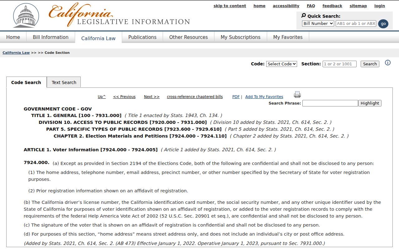
A privacy statute can explain why an expected name does not appear; absence from an authorized file is not proof that a person is absent from the block.
Daly City Community Watch and Neighborhood Groups
Daly City Community Watch can form around a street, marina, recreation center, or park. Registration asks an organizer for a name, full mailing address, phone, and email. The city provides tools such as a phone tree, family data, property inventory, and sign-in sheets for safety administration. The city does not publish a public membership roster, so those materials should never be turned into a neighbors directory.
Public group contacts can help with civic participation or local history. They do not establish who belongs to a block. The city's police-record process also shows why an official file can require a form, identification, and a releasability review.
The municipal records route is visible in the public report instructions.
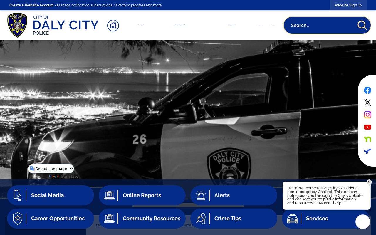
A report request can identify access steps, but a releasable incident report still is not a block roster.
Note: A public organizer contact can support civic connection without exposing the private membership behind a neighborhood group.
Westlake, Serramonte, and Daly City Edges
Neighborhood names carry record history. The older core around Mission Street, Hillside, and Crocker can appear in early maps and directories. Westlake rose on postwar land and was annexed in 1948. Serramonte and St. Francis Heights reflect later expansion. Broadmoor remains an adjacent unincorporated community. The postal layer can cross these lines, so a Daly City neighbors search should note neighborhood, municipal status, ZIP, and APN separately.
Colma's cemetery district, San Bruno Mountain, the San Francisco line, and the Bayshore or Visitacion-area edge add more geographic overlap. Use the map, not a neighborhood label alone, to decide which parcels sit beside the subject address. Then use the record custodian that covers the parcel.
Permits and Sanborn Maps for Block History
Permits and maps explain how a block changed. Daly City's EnerGov public portal advertises permits, plans, code cases, requests, businesses, fire occupancies, and operational permits. The research did not expose its configured field labels or exact historical cutoff. For an older address jacket, request the file from Building and Planning under the California Public Records Act, using the state CPRA guidance alongside the address, parcel, date range, and record type.
Library of Congress Sanborn sheets from 1915, 1918, 1927, and 1950 can show building footprint, materials, use, and street-number context. They do not name occupants. A permit applicant, contractor, map label, or newspaper event can add a dated block story without claiming a complete list of neighbors.
For a whole street chain, use the dedicated Daly City street directory address method; the neighbors page stays at the block and community scale.
Official Rolls Versus Commercial Neighbor Tools
Commercial compilation tools may combine public filings, marketing data, and stale associations. They can merge names, omit protected changes, and show an old address without the source context. Official records are narrower but explain the custodian, date, field, and access rule. Use any compilation only as an unverified lead, then return to the source office.
| Source type | Strength | Limit |
|---|---|---|
| County GIS and parcel resources | Shows block geometry, APNs, and property context | Does not establish occupancy or complete names |
| Recorded deed index | Dates parties to a land instrument | Does not list ordinary household use |
| City permits and reports | Shows official applicants, work, or releasable incidents | Access, exemptions, and historical coverage vary |
| Commercial compilation | May suggest a name or old association quickly | Source, date, accuracy, and privacy limits may be unclear |
A source with a clear date and custodian is the better basis for a statement about a Daly City block.
Daly City Neighbor Lookup Limits
A Daly City neighbors search cannot identify every household member, visitor, nonowner occupant, utility customer, library borrower, or protected participant. Safe at Home can substitute a mailing address for eligible people, and California law restricts DMV and voter information. Community Watch registration and neighborhood-group contacts are safety administration, not public membership records.
Lawful use. Use block records for personal safety awareness, genealogy, local history, and civic connection. Do not use a neighbor lookup to stalk, harass, threaten, intimidate, or harm anyone. Stop when the next step would require private information.
The strongest final note distinguishes a parcel, owner, recorded party, permit applicant, organizer, and resident. The source's own wording is part of the evidence.