
Daly City ZIP Codes and Their Coverage
The practical ZIP code directory for Daly City begins with 94014 and 94015. USPS, rather than the city, defines postal delivery names and routes. The descriptions below are geographic research aids, so verify an individual address in the live USPS lookup before routing it to a county or city record.
| ZIP | General Daly City coverage | Post office or station | Notes |
|---|---|---|---|
| 94014 | Eastern and northeastern Daly City, including Original Daly City, Top of the Hill, Mission corridor, Hillside, Crocker, and the Southern Hills or Bayshore side | Street delivery; verify current station in USPS locator | Extends beyond the city; older directories used the east side of Junipero Serra Boulevard |
| 94015 | Western and southern Daly City, including Westlake, St. Francis Heights, Serramonte, and areas west of I-280 | Street delivery; verify current station in USPS locator | ZCTA extends outside the city; older directories used the west side of Junipero Serra Boulevard |
| 94016 | Daly City-associated PO Box designation in some references | PO boxes if currently active | Current USPS classification and range need live verification |
| 94017 | Daly City-associated unique or PO Box designation in some references | Nonstreet or unique if currently active | Do not treat as an active city-serving ZIP without current USPS confirmation |
The USPS city and state ZIP lookup is the source for current delivery verification. The two street-delivery ZIPs are the heart of the Daly City ZIP code directory; 94016 and 94017 remain explicit research gaps.
94014 in Eastern Daly City
ZIP Code 94014 organizes the eastern and northeastern part of Daly City, including the older core near Mission Street, Top of the Hill, Hillside, Crocker, and the Southern Hills or Bayshore edge. Its statistical geography is larger than the incorporated city. Census 2020 relationship data places 36.03% of Daly City's land in the 94014 ZCTA, while only 43.06% of the total 94014 ZCTA lies inside Daly City.
That overlap matters when a ZIP search returns a nearby address. Confirm the street and municipal jurisdiction in San Mateo County GIS, then use ACRE parcel resources if the question becomes one of ownership or property history. A ZIP field does not replace the APN, situs, legal description, or city department that keeps a permit.
Note: A 94014 mailing label can point beyond Daly City, especially near the county, Colma, and San Francisco edges.
94015 Across Westlake and Serramonte
ZIP Code 94015 generally covers western and southern Daly City, including Westlake, St. Francis Heights, Serramonte, and areas west of I-280. Census relationship data places 63.97% of Daly City's land in the 94015 ZCTA, and 86.40% of that ZCTA lies inside the city. The overlap is closer than 94014, but it is still not identical to the municipal boundary.
Westlake's development era also changes the likely historical source. Westlake rose after the older Mission and Hillside core and was annexed in 1948. Later directories, subdivision deeds, assessor maps, and permits may be more useful than a 1915 building sheet. The ZIP code directory can narrow the geography, but the address record decides the next search.
ZIP Lines and Daly City City Limits
ZIP Codes are delivery geography. ZCTAs are Census statistical approximations. Daly City boundaries are municipal geography. Those systems overlap without matching. The Census relationship table for 2020 shows that every square meter of incorporated Daly City falls within the 94014 or 94015 statistical ZIP approximations, while both ZCTAs also cover land outside Daly City.
Use the Census ZCTA-place relationship data for the statistical comparison and the USPS locator for a deliverable address. Do not infer county, city, assessor, court, or election jurisdiction from ZIP alone.
The Census relationship file is the source for the land-share comparison between Daly City and each ZCTA.
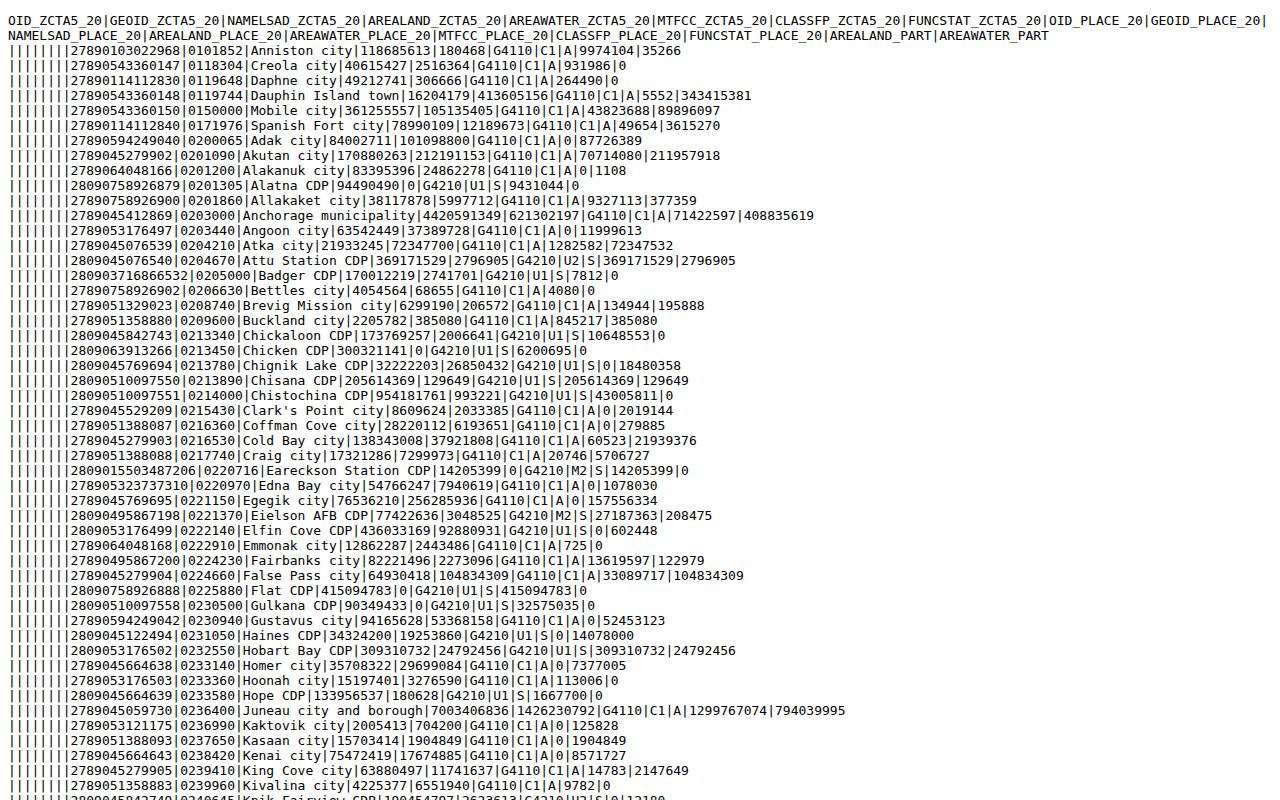
The statistical overlap is useful context, but it does not create a USPS route boundary or a resident list.
- ZIP versus ZIP+4
- A ZIP names a delivery area; ZIP+4 adds a narrower delivery segment.
- PO-box ZIP
- A postal code organized around post-office boxes rather than ordinary street delivery.
- Unique ZIP
- A code assigned to one organization, facility, or special delivery use.
- Carrier route
- A delivery path within a ZIP, not a public list of people on that path.
- ZCTA
- A Census statistical approximation of ZIP geography, not a USPS route boundary.
Finding Residents by Daly City ZIP Code
A ZIP code directory search should narrow a geography before it chooses a record source. No county portal documented in the research produces a public ZIP-wide resident list. Parcel, deed, permit, court, voter, and historical tools use different keys. Use the ZIP to define a manageable set of addresses, then shift to the official source that can answer the narrower question.
- Verify the address and ZIP through the USPS city, state, or full-address lookup.
- Compare the postal result with Daly City limits and parcel geometry in county GIS.
- Use ACRE parcel and assessor maps to identify APNs and situs addresses for the selected area.
- Search RecorderWorks, permits, or historical directories by the exact address or parcel, keeping dates beside names.
- For a single person, use the official record type that fits the question rather than treating a ZIP as a people index.
Once a ZIP narrows the area to a named street, continue with the Daly City street directory by address for the parcel and deed chain.
Verify a Daly City ZIP with USPS
The USPS lookup is the live postal check. Its city-and-state route can identify ZIPs associated with a place name, while the full-address route is the better test for a particular delivery point. Keep the returned city, state, ZIP, and any ZIP+4 separate from the county parcel record. A historical directory's post office label is evidence of its publication context, not a current USPS ruling.
The USPS lookup interface provides the current address route.
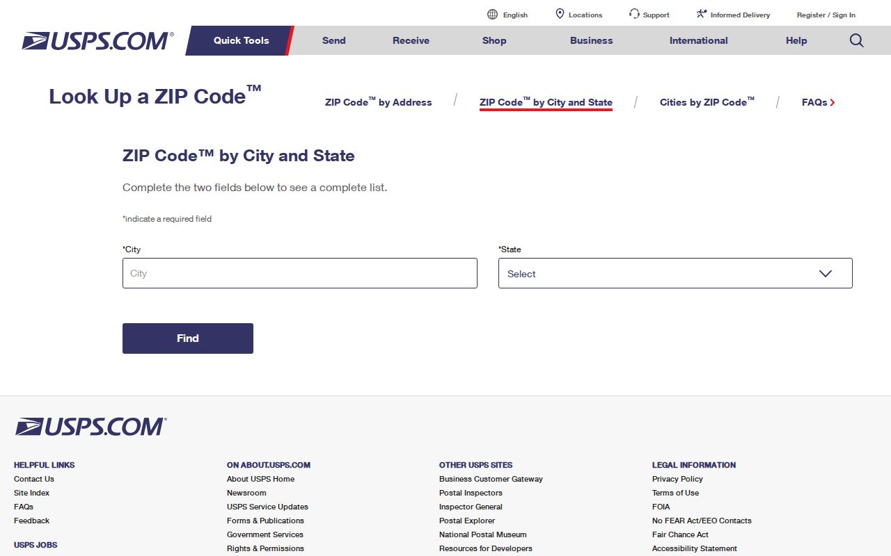
Use the returned postal result to choose the next county or city search, then confirm the record's jurisdiction independently.
| Lookup step | Why it matters |
|---|---|
| City and state | Shows the ZIPs USPS associates with the place name. |
| Full street address | Tests a specific delivery point instead of a broad city label. |
| ZIP+4 result | Narrows delivery, but does not change parcel or city jurisdiction. |
| Current result date | Separates live postal data from an older directory or map. |
Use GIS After a ZIP Search
County GIS can test the boundary question that USPS cannot answer. Search or zoom to the address, activate parcels, select the polygon, and compare the city, county, district, zoning, hazard, and unincorporated flags. The county feature data can expose APN, situs components, assessor map, year built, land and building area, use description, and geometry. Daly City zoning remains municipal.
The GIS gateway is a map and open-data resource, not a ZIP-keyed resident directory. A parcel may be retired, combined, or represented differently across layers. Use the APN and legal description to move into ACRE, deeds, permits, or tax records. The county GIS viewer is the right place to compare postal and municipal geography before making a location claim.
GIS relationship data makes a ZIP boundary visible, but it does not imply that a person lives at every parcel in the layer.
Note: A ZIP narrows the map; the APN and custodian determine which record can support the next claim.
Why ZIP Filters Are Not Resident Rosters
California's public record systems do not share one ZIP filter that lists everyone in Daly City. The assessor may expose parcel facts, the recorder indexes transactions, the court indexes cases, and the voter portal verifies only the matching voter. A directory volume may have a ZIP or street heading, but its scope may be commercial or civic. A business address is an affiliation, not a private household.
For authorized election research, Elections Code §§2188 and 2194 control the application, purpose, and security terms for voter information. A personal ZIP search cannot be used to assemble a public block list from the voter file. The same principle applies to private utility, library, delivery, and community data.
Comparison: USPS answers where mail goes; GIS answers where a parcel and boundary sit; ACRE answers what a property record contains; a court or vital custodian answers its own record type. None alone is the Daly City ZIP code directory imagined by a broad name search.
94016 and 94017 Need Current Checks
Some postal references associate 94016 and 94017 with Daly City PO Box, unique, or nonstreet use. The research did not verify a current USPS classification or range for either code. That uncertainty matters because a label that appears in a historical or third-party reference may not be an active city-serving street code.
Do not build a ZIP code directory table that presents either code as a current street-delivery area. Test the code and exact address in USPS, then record the lookup date and returned service type. If a postal source conflicts with a county map, keep both statements scoped to their own systems and ask the custodian for clarification.
Note: An explicit research gap is safer than turning an unverified PO Box reference into a current neighborhood claim.
Daly City Postal History and Neighborhood Labels
The 1972-73 directory listed historical post offices at 1100 Sullivan, 6025 Mission, 199 Southgate, and 7373 Mission. Those addresses belong to the directory's period and should not be presented as current facilities. Older entries also reflect the city's growth: the older core around Mission Street, Hillside, and Crocker has early maps and directories, while Westlake and Serramonte rely more on postwar directories, subdivision deeds, assessor maps, and permits.
Broadmoor's separate municipal status, Colma's nearby cemetery district, San Bruno Mountain, and the San Francisco line make postal and civic geography easy to confuse. Search the historical label printed in the volume, then return to APN, legal description, and current USPS data for present-day verification.
ZIP Code Boundaries Versus Daly City Limits
The right conclusion from a ZIP code directory is usually geographic: an address falls within a delivery or statistical area that overlaps Daly City in a known way. It is not a conclusion about who lives there. If the question shifts to a person, property, court file, or historic household, carry the address into the appropriate custodian's search and state the exact date.
Keep three labels in the research notes:
- Postal: the USPS city, state, ZIP, and delivery route returned for the address.
- Municipal: whether the parcel sits within incorporated Daly City.
- Record: the county, city, court, library, or state office that actually holds the evidence.
That separation prevents the ZIP code directory from overstating what postal geography can show.