
Daly City Previous-Resident Sources
A house history needs an era map. Each source below contributes a different kind of evidence, and no one row proves a complete list of people who used the address.
| Source | Years it covers | Where held | What it shows |
|---|---|---|---|
| RecorderWorks | January 1, 1985 to present index | Online and Recorder counter | Recorded parties, dates, instrument types, and property links |
| Older deed books and indexes | County formation era through 1984 | San Mateo Recorder counter and archive | Earlier grantor-grantee chain and legal descriptions |
| Daly City 3R report | Permit history after January 1989 | Daly City Building and Planning | Permits, enforcement, zoning, and city-determined legal use |
| Commercial and civic directories | 1939; 1969-70 through 1977-78 selected years | Library digitization and Internet Archive | Businesses, addresses, phones, officials, schools, churches, groups |
| Census schedules | 1850-1950 public schedules | NARA, FamilySearch, and library access | Enumerated household at a census date |
| Sanborn maps | 1915, 1918, 1927, 1950 editions | Library of Congress | Building footprint, use, materials, and street-number context |
| Obituary, probate, and estate deed | Event-specific | Newspapers, Superior Court, Recorder | Death, heirs, estate representatives, and conveyance clues |
Use the table as a sequence, not a promise. The earliest and latest source may be strong while the middle years remain uncertain.
Start with Today’s Daly City APN
The parcel is the stable anchor for previous residents. Search the address in San Mateo County GIS or ACRE parcel resources, copy the APN, situs, map reference, current owner label, and document number, then compare the legal description. Keep the physical situs separate from the tax mailing destination. A parcel can carry a trust, LLC, estate, or combined owner display, none of which tells you who lived inside.
The current ACRE parcel-information route can connect the address to assessor maps and tax resources. The county GIS viewer helps test parcel shape, adjacent lots, municipal limits, and old neighborhood labels. If the parcel is retired or combined, use lot, block, subdivision, and legal description to bridge the record.
- APN
- Assessor Parcel Number, the county identifier for the mapped land unit.
- Chain of title
- The dated sequence of conveyances and other title instruments tied to the land.
- Legal description
- The written or mapped land identity that survives a street-label change.
- Grantor
- The party transferring an interest in a recorded instrument.
- Grantee
- The party receiving an interest in that instrument.
The APN does not name every earlier household, but it prevents a street-name change from breaking the land trail.
Walk Seller to Buyer Back Through 1985
RecorderWorks is the online starting point for a Daly City property chain. Its property-document index begins January 1, 1985. Search the current owner or recorded grantee, filter by date and document type, open the indexed result, and compare the APN or legal description. Take the earlier seller or grantor and search that name as a prior grantee. Repeat until the online period is exhausted.
- Open RecorderWorks and test All, Grantor, and Grantee name roles with spelling variants.
- Use a recording-date range and retain deeds, deeds of trust, releases, reconveyances, maps, and relevant court orders when the trail is unclear.
- Record instrument number, recording date, type, parties, and APN or legal-description match.
- Use the earlier grantor as the next grantee lead, checking that the land identity still aligns.
- At the 1985 boundary, move to the Recorder counter and historical books instead of ending the search.
The index is free, but online images are not supplied. Public terminals at 555 County Center permit free viewing; copies and certification follow the current fee schedule.
The historic directory scan below is a reminder that a publication page and a deed instrument answer different questions.
Use the volume as a dated context lead, then return to the deed chain for land transfer evidence.
Note: A party-name hit becomes useful only after its instrument, date, APN, or legal description matches the address.
Continue in San Mateo Deed Books
Pre-1985 work takes place through the Recorder's counter, historical indexes, and older books. Bring an APN, legal description, party name, approximate date, map reference, or known instrument number. The clerk can explain how to view or copy a supplied record, but does not perform an open-ended genealogy search or offer title advice. If a name search fails, try the property description, business or trust name, alternate spelling, and both party roles.
The current research notes identify separate routes for filed paper, certification, recorded maps, research files, and conformed copies. Recording charges are different from copy charges. Confirm the live fee schedule and payment instructions before mailing a check. A physical counter search can reveal an earlier link that the online portal's coverage will never return.
The County Clerk-Recorder access page is the practical starting point for counter contact and record groups.
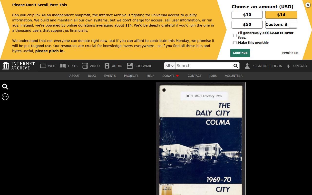
Older directory pages can support a household or business clue after the title chain establishes that the address is the same land.
Daly City 3R Reports After January 1989
Daly City's Residential Requirements Report is a local house-history source for property with three or fewer units before sale. The report is valid for six months and includes permit history after January 1989, enforcement history, zoning history, and city-determined legal use. The current research lists a $124 fee effective July 1, 2025 and email delivery within three working days. It cannot show unpermitted improvements.
Request the report online or contact Building Division at City Hall, second floor, 650-991-8061, or 3r_reports@dalycity.org. The broader EnerGov public portal advertises public permit search, code cases, requests, businesses, fire occupancies, and operational permits. The configured field labels and older cutoff were not exposed in the research, so ask Building and Planning for an address jacket when the online record is thin.
Quirk: A clean 3R result does not rule out work that was never permitted. Treat it as a municipal record of what the city has, not a complete construction history.
Sanborn Maps and Daly City Building Context
Sanborn fire-insurance maps can help match an old address to a building footprint. The Library of Congress holds Daly City-area editions from March 1915, June 1918, June 1927, and June 1950. They show footprint, materials, use, and street-number context. They do not name occupants. Use the map to test whether a historic number or structure fits the current parcel, then use a directory, census, deed, newspaper, or probate source for people.
Daly City's older Mission Street, Hillside, and Crocker core may reach the early Sanborn sheets. Westlake developed after the older core and was annexed in 1948, so subdivision deeds, later directories, assessor maps, and permits may carry more weight there. No official citywide renumbering year was located. APN, lot, block, and legal description are the bridge when the number shifts.
The Library of Congress Sanborn collection supplies map context for a previous-residents search.
Maps explain the place; they do not turn a footprint into a named household.
Note: Sanborn sheets can bridge an old number or building shape, but a separate record must supply the person or household name.
Reverse Directories for Past Daly City Households
The verified Daly City/Colma volumes are commercial and civic directories, not a confirmed complete reverse-directory run. They can show a business, phone, organization, official, school, church, or address association. A name may appear because of a business or civic role rather than a household. A missing name is weak evidence because coverage, section scope, OCR, and publication gaps all matter.
Search the page image and full-text OCR for the exact number, street variant, business, relative, and neighborhood. Capture the publication year and page. Then compare the result with the APN, deed date, 3R report, newspaper, or census. The Daly City city directory collection page explains the identified volumes and how their entries read.
The next archive page supplies a separate historical directory snapshot.
Use a directory hit as an address or affiliation clue, then corroborate it through a source with a clearer date or record purpose.
Pair Daly City Directories and Census
The federal population census supplies an enumerated household at a census date, while a city directory supplies a publication-period address or affiliation. The public schedules run through 1950 under the 72-year federal rule. Locate the address and enumeration district, compare names and ages, and keep the census date distinct from the directory date. Later directory gaps cannot be silently filled by a census result.
- Use the directory's street number, street spelling, neighborhood, or nearby institution to identify a likely census area.
- Find the 1940 or 1950 enumeration district and inspect the schedule at the address.
- Compare household names, ages, relationships, and address order without assuming a perfect spelling match.
- Check a deed, obituary, newspaper, or probate record for a separate dated confirmation.
NARA and FamilySearch are finding routes for census schedules. A library database may add access, but the schedule's enumeration date controls the conclusion.
Obituaries, Probate, and Estate Deeds
A previous-residents trail often ends when an owner dies, an estate is opened, or a trustee conveys the parcel. Search newspapers and obituaries by name, old address, relatives, funeral home, and neighborhood. Probate can identify an estate representative, heirs, creditors, and property references when the file is public and unsealed. A later deed from an estate, trustee, or executor can connect that person to the APN.
San Mateo Superior Court's MIDX is an index lead, while filed documents and copies require lobby, mail, or archive procedures. The Recorder indexes the later conveyance. Compare the legal description and dates before treating an heir name as the next resident. An obituary can identify relationships but does not by itself prove that every relative lived at the property.
Human-use trail: APN → deed party → probate petition → heir or representative → estate deed → next dated address source.
Note: Probate can identify heirs and representatives, but an heir relationship is not proof of residence at the property.
Solve Address Changes with Legal Description
Daly City address history can be disrupted by subdivision renaming, annexation, unit renumbering, old postal labels, and the Broadmoor or Colma boundary. The research found no official citywide renumbering year. When an old directory or deed uses a different number, compare APN, lot, block, subdivision, map, and building footprint. Do not assume the previous residents moved because a street label changed.
The durable answer is a chain of matching land evidence. A historical directory, Sanborn sheet, or newspaper can explain the old label. A deed and legal description can establish continuity. A current GIS parcel can show whether the land was split or combined. State each bridge as an inference and name the source that supports it.
Note: A street number is convenient for searching, but the legal description is the stronger identity when Daly City's map or postal labels change.
Lawful Limits on Previous Residents Research
Previous residents research can support family history, property history, estate work, and civic understanding. It cannot reveal every person who occupied an address, and a deed party is not automatically a household member. California's Safe at Home program can protect eligible participants with a substitute mailing address, while DMV, voter, utility, library, sealed court, and confidential vital information remain restricted.
House-history use. Use the APN, deed chain, directories, maps, census, newspapers, and probate records for a documented personal research purpose. Do not use a previous-residents search to stalk, harass, threaten, or harm anyone. Confirm important facts with the source custodian.
A careful conclusion says “recorded party,” “directory listing,” “enumerated household,” or “probate heir” instead of collapsing those terms into “resident.” That distinction is what makes a backward trail accurate.